Google maps? Tucked away in the Vatican Museums, the Gallery of the Geographical Maps is a true hidden gem. This breathtaking corridor brings the world of 16th-century cartography to life, offering a fascinating glimpse into how Italy was perceived centuries ago. Here are some fun and intriguing facts about this extraordinary space that will make your visit even more special!
The 16th Century’s Version of Google Maps
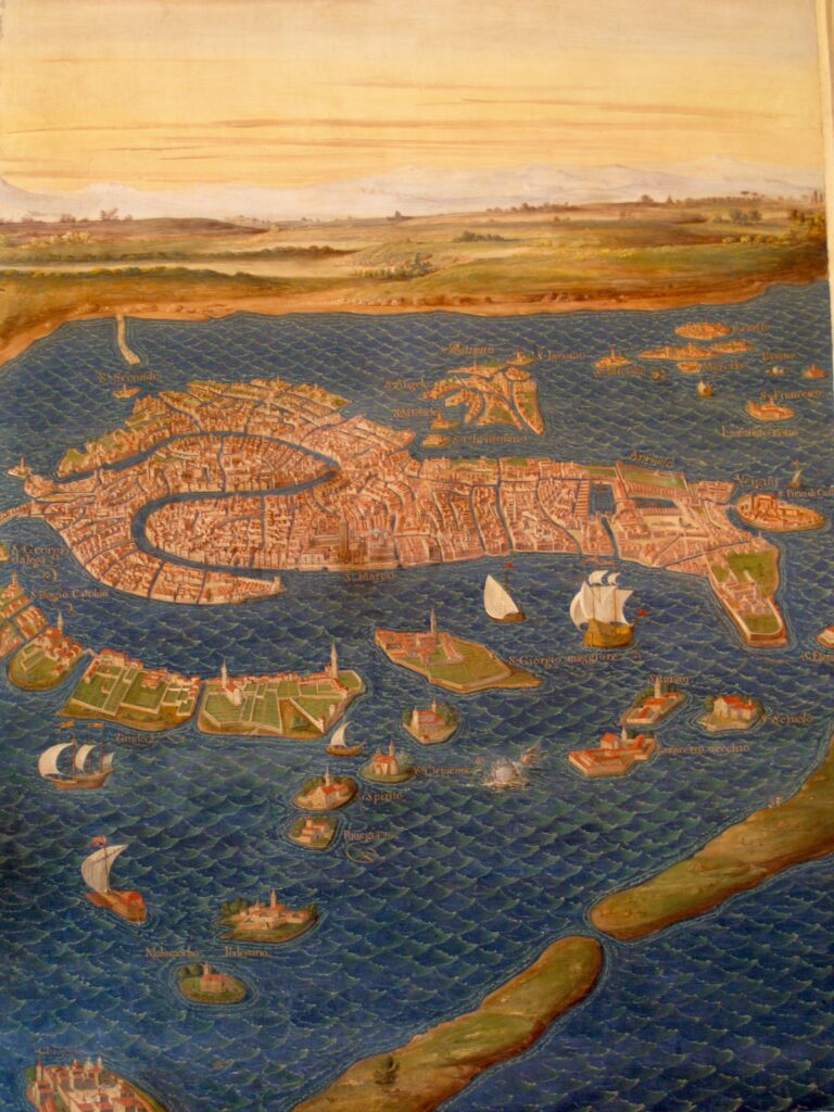
Believe it or not, these maps were considered cutting-edge at the time! Long before satellite images, they provided an incredibly detailed look at Italy’s geography, featuring mountains, rivers, cities, and even the tiniest villages. It’s amazing to see how precise Renaissance mapping could be!

A Hallway of Stunning Maps
Spanning an impressive 120 meters (394 feet) in length and 6 meters (20 feet) in width, this gallery is one of the longest in the Vatican Museums. Lining its walls are 40 magnificent, frescoed maps, each showcasing a different region of Italy, its islands, and the papal territories. It’s like stepping into a giant, Renaissance-era atlas!
A Pope’s Grand Vision
Pope Gregory XIII commissioned these incredible maps in 1580 with the goal of creating an accurate and detailed representation of Italy. In just three years (1580–1583), the project was completed under the guidance of Ignazio Danti, a skilled Dominican friar and cartographer.
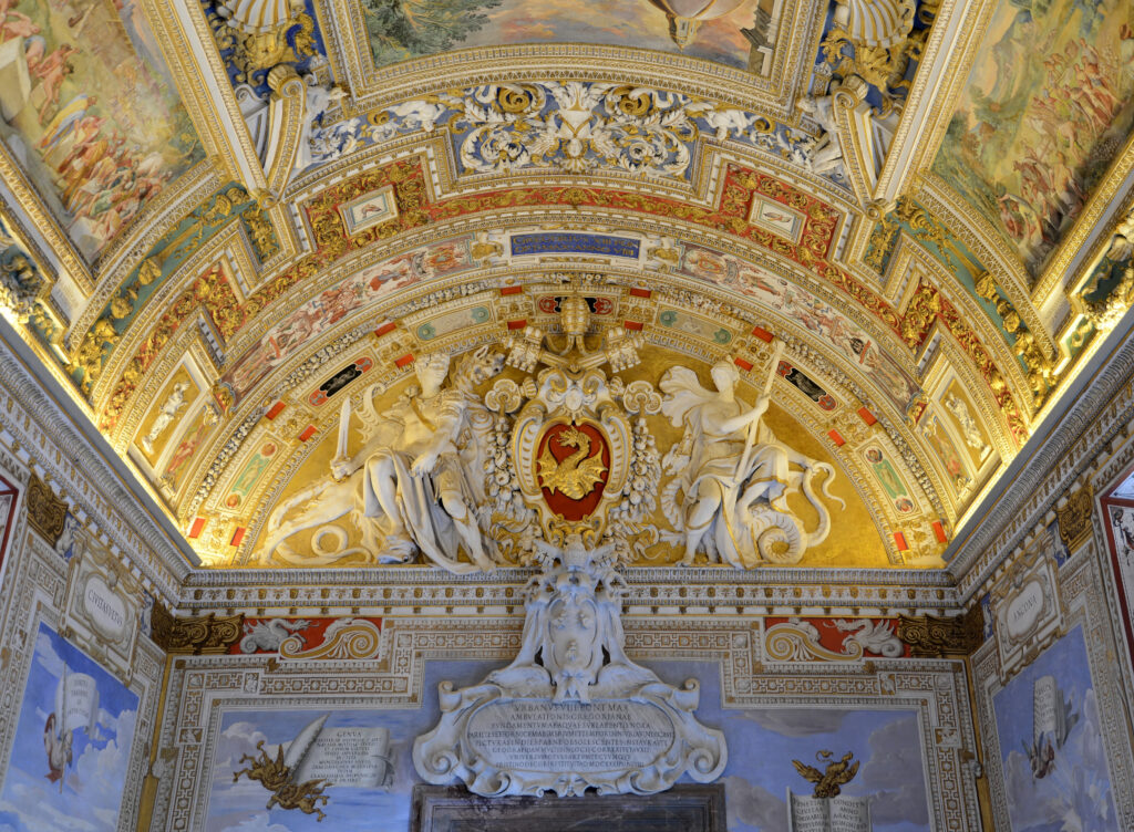
Hidden Stories in the Artwork
Beyond their geographic accuracy, the maps are filled with symbolism and historical references. Many include biblical and mythological elements, emphasizing the deep connection between the Church and the lands it governed. And don’t forget to look up—the gallery’s ceiling is a masterpiece, decorated with frescoes depicting historical and religious events tied to the regions below.
A Snapshot of Italy’s Past and Present
While these maps were state-of-the-art in the 16th century, Italy’s landscape has evolved over time. Coastlines, for example, have shifted due to both natural and human-made changes. Today, historians and geographers still study these maps to better understand how Italy’s geography has transformed.
A Historic Papal Walkway
This stunning gallery wasn’t just for admiring maps—it also played a key role in Vatican traditions. Popes and clergy members used it as a passageway for important processions, reflecting on the vast territories under their spiritual and political influence as they walked through.

A Must-See Photo Spot
With its golden-hued ceiling, vibrant frescoes, and breathtaking details, the Gallery of the Geographical Maps is one of the most photogenic places in the Vatican Museums. Whether you’re capturing its artistry or simply soaking in the atmosphere, this spot is Instagram-worthy!
Why You Can’t Miss It
More than just an artistic treasure, this gallery is a time capsule of Renaissance science, history, and Vatican influence. Whether you’re a history buff, an art lover, or just looking for something awe-inspiring, the Gallery of the Geographical Maps is a must-see highlight of any Vatican visit!
Plan Your Visit
The Gallery of the Geographical Maps is part of the Vatican Museums tours, leading visitors toward the Sistine Chapel. To get the most out of your visit, consider joining a guided tour—expert historians can reveal even more fascinating details hidden within these masterpieces.